HikeWest plans to publish an online resource and/or handy guide book for walks of the Southwest Region; mainly circuit day walks and multi-day bushwalks, and mostly of minimum 15km length. These will mostly not duplicate bushwalks that are already online elsewhere, but will include some loops off the Bibbulmun Track and Cape to Cape Track. They will give experienced walkers opportunities and motivation to reach many excellent locations in the southwest that are bypassed by the Bibbulmun Track.
As of late November 2022, a draft of the book is with DBCA – Parks and Wildlife for feedback prior to publication.
Many of the walks will intentionally be reasonably adventurous to give walkers opportunities to challenge themselves beyond the more developed trails. The resource will help restore some excellent, long-overlooked SW walk areas to the schedules of today’s bushwalkers.
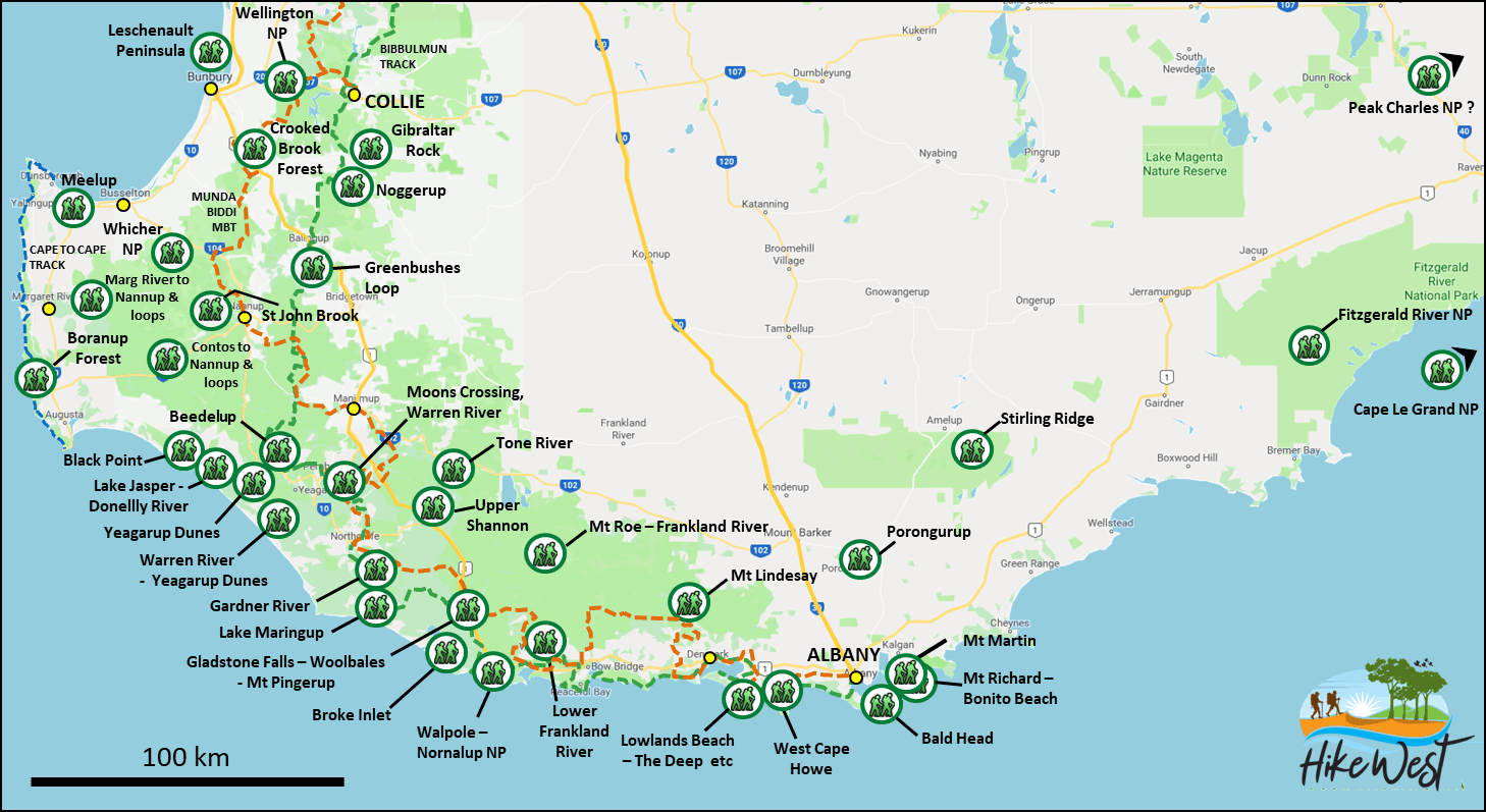
Read MoreSince starting the project, we have initial walk summaries including maps and GPS files for around thirty excellent walk possibilities in the SW Region (see map and list). These walks visit at least 18 national parks ranging from Wellington National Park in the north (near Collie) to the various NPs along the SW and southern coast. As most of the suggested routes are new or substantially changed from previous ones in the areas, such as those in the 1985 “Forests on Foot” book, they need testing.
Twenty of the new walk routes across the South West have so far been posted onto local bushwalking website WalkGPS with limited access. WalkGPS is partnering with HikeWest on this project on a voluntary basis, initiating test routes, conducting ‘recces’, generating GPS files, gathering photos, preparing maps & walk descriptions, and using the WalkGPS website to enable the walks to be posted easily online. The Crooked Brook Forest Walk uploaded in January 2020 is an example of the walk information becoming available from the project.
Further new walk descriptions are being posted by WalkGPS. Access to most of these will initially be limited to WalkGPS subscribers, and also to new Individual HikeWest Members under special, limited-period offers, as a recognition of their support of HikeWest’s voluntary efforts for bushwalking/hiking in WA.
If you are keen to contribute to testing the walks or to providing information about these or other walks from your own past experience in some of the areas, do contact us now!
Back to top